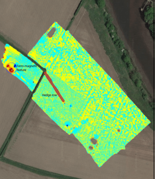
PLANIT’s non-intrusive UXO survey utilises the latest generation of proven magnetometers to identify ferrous anomalies beneath the ground likely to be Explosive Ordnance (EO). These anomalies may be subsequently exposed to determine their nature.
Where it can be applied, non-intrusive survey provides the quickest option for surveying a given area for EO, identifying potential threats quickly, saving time and money. Preliminary results can be delivered on site in most cases followed by formal reporting within 24hrs. PLANIT’s survey results are presented in a transparent way so the client can be confident in our results.
Non-intrusive detection depths for items of UXO vary depending upon the size of the ordnance and the nature of the ground; high levels of environmental ferrous contamination (scrap metal, reinforced concrete or industrial clinker for example) can reduce the maximum detection depths for non-intrusive magnetometry.
It is important to assess both the detection depth required on your site (i.e. the greatest depth to which EO is expected to be encountered) and whether environmental conditions will adversely affect magnetometry.
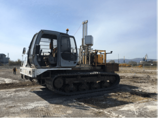
PLANIT employs intrusive EO survey to detect deep buried UXO using a magnetometer delivered into the ground by one of two methods:
As a benchmark, a 50kg bomb is detected out to a radius of up to four metres from the axis of the magnetometer. This approach reaches below surface, ferrous clutter that may limit non-intrusive survey (i.e. reinforced concrete) and achieves detection depths to cover the deepest penetration of Unexploded Bombs (UXBs) below ground.
Intrusive survey is most effectively used to ensure that pile and/or site investigation positions are safe from the presence of EO, where non-intrusive survey methods cannot be used; intrusive survey is designed for surveying columns within the ground volume, not as an area survey technique.
PLANIT provides the most appropriate equipment for a Client’s site by assessing the nature of the proposed development, the identified EO risk and the ground conditions.
PLANIT EO Engineers are all appropriately qualified and experienced to provide support to those working within EO threat areas.
PLANIT personnel are provided with full supporting documentation detailing their qualifications and experience and are backed up by an expert technical team constantly on call.
Our EO Engineers can:
PLANIT will provide telephone/ email ‘Referal’ Services, 24/7, to which Client’s may refer information about suspected EO finds/ incidents for the PLANIT expert to determine an appropriate course of action. The dedicated, freephone number will be assigned upon appointment.
PLANIT will provide ‘On Call’ EO Emergency Response Services allowing a timely on-site expert presence to deal with suspected items of EO that present a threat to key assets. Response times are pre-agreed with the client and depend on several factors.

PLANIT offers comprehensive Utility Survey services, employing 'state of the art' technologies, helping you to identify and avoid hidden obstacles to your development or to confirm the viability of existing utility infrastructure.
We offer the following services:
Our survey technologies can also be applied to locate, identify, and/or investigate the following:

PLANIT delivers comprehensive Archaeological Magnetometer Survey solutions, using 'state of the art' technologies and class-leading professionals, to identify archaeological heritage prior to development or as part of research and conservation projects.
We provide the following archaeological services: